Image GVP-02767
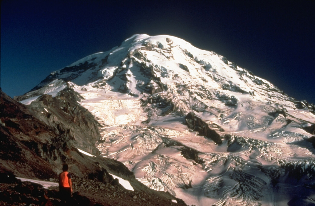
A volcanologist from the U.S. Geological Survey observes the glaciated NW flank of Mount Rainier during a field survey to conduct monitoring measurements on Ptarmigan Ridge. The North Mowich Glacier in the center of the photo descended to about 1,500 m elevation when this photo was taken in 1983.
Photo by Lyn Topinka, 1983 (U.S. Geological Survey).
![]() This image is made available as a Public Domain Work, but proper attribution is appreciated.
This image is made available as a Public Domain Work, but proper attribution is appreciated.
Galleries: Stratovolcanoes
Keywords: stratovolcano
Rainier