Image GVP-02770
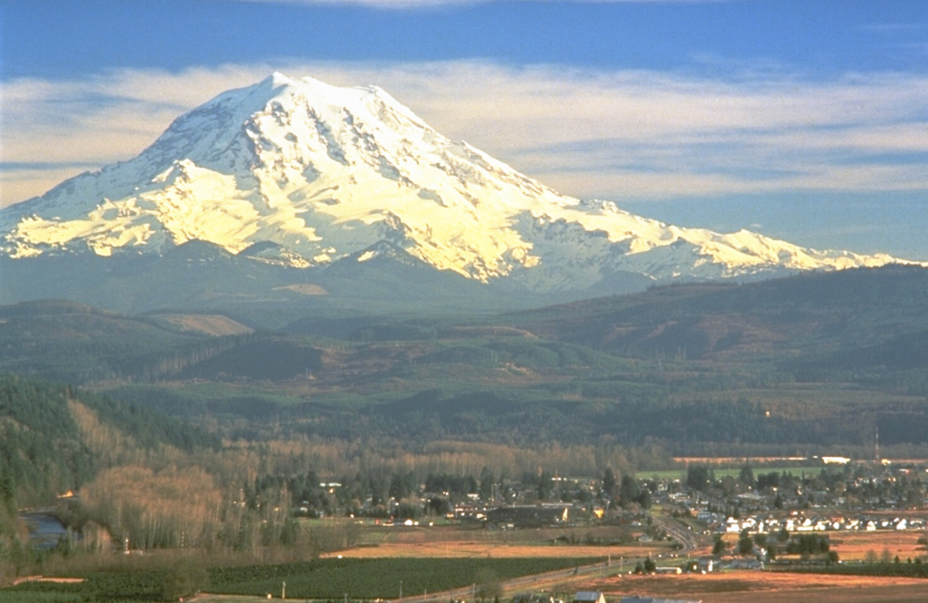
Mount Rainier towers above the town of Orting located 40 km NW in this 1995 photo. The plain underlying the town is composed of the Electron Mudflow, which formed the flat valley floor about 500 years ago. The mudflow, which originated from partial collapse of part of the western flank of Rainier, was about 30 m deep when it exited valleys at the mountain front and flowed onto the Puget Lowland.
Photo by Dave Wieprecht, 1995 (U.S. Geological Survey).
![]() This image is made available as a Public Domain Work, but proper attribution is appreciated.
This image is made available as a Public Domain Work, but proper attribution is appreciated.

Rainier