Global Volcanism Program | Image GVP-02779
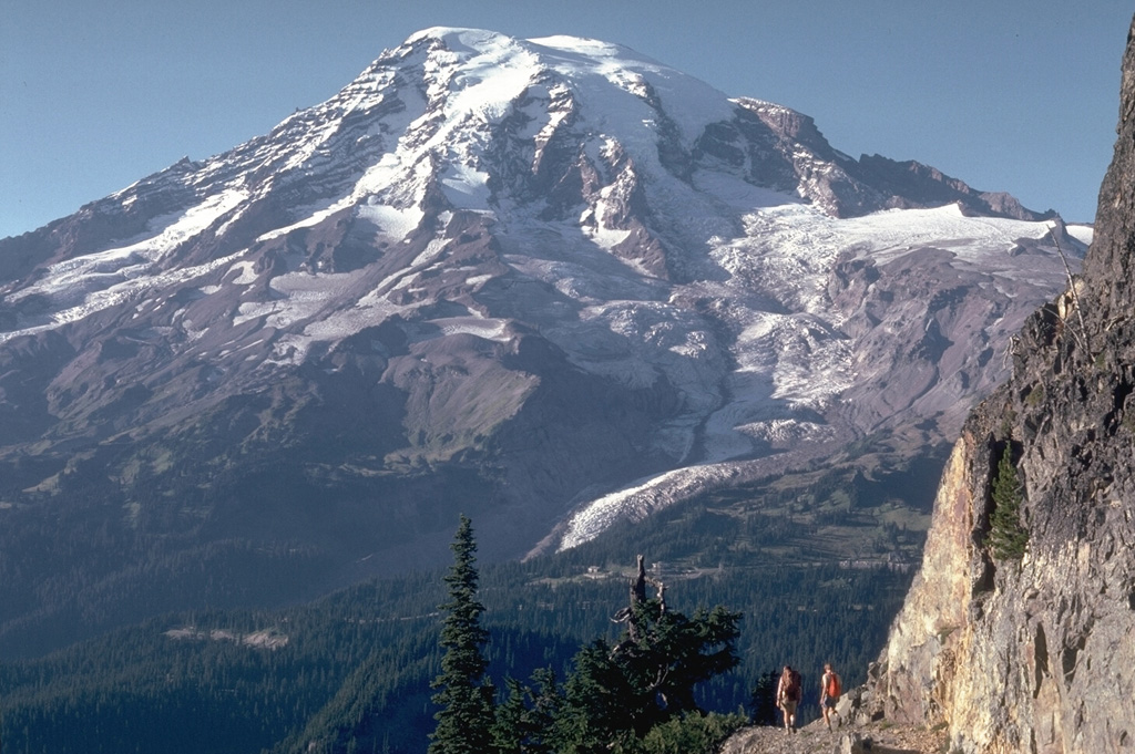
The south flank of Rainier is seen here from the Tatoosh Range, with the Nisqually Glacier below the snow line in this 1980 photo. Meadows and forests of the Paradise area lie immediately below and to the right of the glacier. This is one of 25 named glaciers on Rainier, with the snow, ice, loose rock, and hydrothermal alteration posing a risk of lahars and debris avalanches for surrounding areas.
Photo by Lee Siebert, 1980 (Smithsonian Institution).
![]() This image is made available under the Public Domain Dedication CC0 license, but proper attribution is appreciated.
This image is made available under the Public Domain Dedication CC0 license, but proper attribution is appreciated.
Galleries: Stratovolcanoes
Keywords: stratovolcano
Rainier