Image GVP-02861
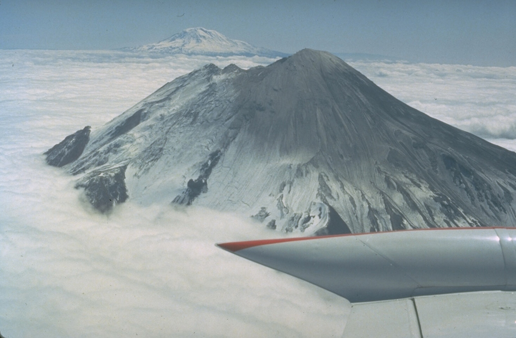
This 16 May 1980 photo, taken two days before the catastrophic eruption, shows Mount St. Helens from the west with Mount Adams in the background. The two notches immediately to the north of the summit crater mark the top of the N-flank bulge, an uplifted and deformed area that collapsed in a massive landslide on 18 May, triggering the lateral blast that devastated areas to the north.
Photo by Bob Christiansen, 1980 (U.S. Geological Survey).
![]() This image is made available as a Public Domain Work, but proper attribution is appreciated.
This image is made available as a Public Domain Work, but proper attribution is appreciated.
Keywords: ashfall | tephra | deposit

St. Helens