Global Volcanism Program | Image GVP-03674
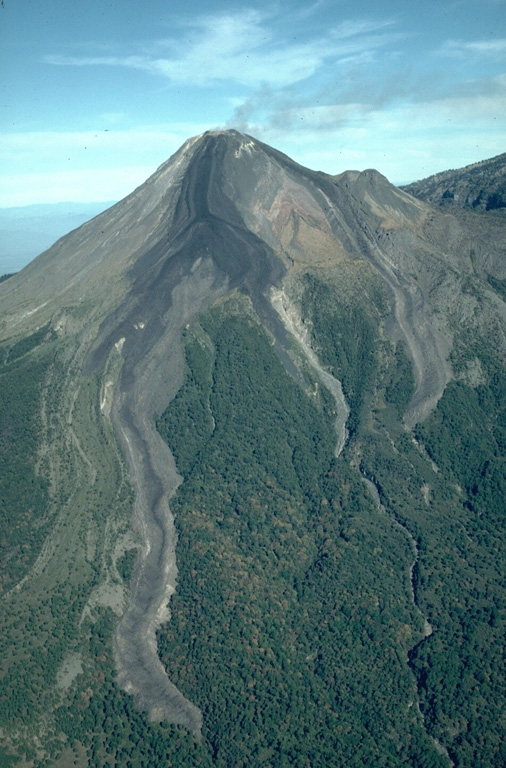
During an eruption from December 1975 to June 1976 lava flows from the Colima summit lava dome descended the E and SE flanks. The SE flow (left) split into two lobes, the longest of which traveled 3.5 km. Another flow traveled initially to the NE before diverting around El Volcancito, the smaller cone on the right horizon, and descended the E flank. All three lobes cross the upper-vegetation line that marks the location of the caldera wall that has been largely buried.
Photo by James Allan, 1981 (Smithsonian Institution).
![]() This image is made available under the Creative Commons BY-NC-ND 4.0 license terms.
This image is made available under the Creative Commons BY-NC-ND 4.0 license terms.
Galleries: Volcanic Gases | Stratovolcanoes | Lava Flows
Keywords: stratovolcano | lava flow | plume | emissions | gas | gas plume | lava lobe

Colima