Global Volcanism Program | Image GVP-04478
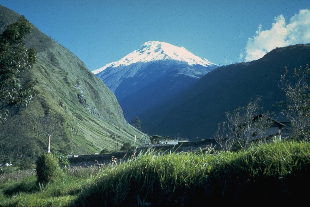
Snow-capped Tungurahua, seen from near the town of Baños on its northern flank, rises 3200 m above steep-walled canyons. Historical eruptions, separated by long reposes, have produced powerful explosions, sometimes accompanied by pyroclastic flows and lava flows. All historical eruptions have originated from the summit crater, and have typically lasted for several years. The largest historical eruptions took place in 1886, 1916, and 1918.
Photo by Minard Hall, 1976 (Escuela Politécnica Nacional, Quito).
![]() This image is made available under the Creative Commons BY-NC 4.0 license terms.
This image is made available under the Creative Commons BY-NC 4.0 license terms.

Tungurahua