Global Volcanism Program | Image GVP-04608
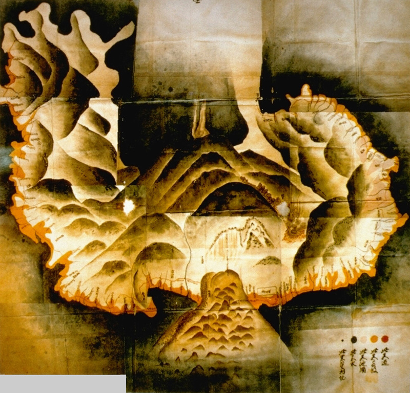
This 18th century watercolor map of Unzen volcano on the Shimabara Peninsula shows the extent of the catastrophic landslide from Mayuyama (lower center) in 1792 that swept into the Ariake Sea at the bottom of the map. The irregular orange-colored area along the coast delineates the extent of runup of the tsunami that was created when the avalanche entered the sea. The tsunami swept a 77-km length of the peninsula and caused nearly 15,000 fatalities here and along the coastlines.
Map from Shimabara City Honko temple (published in Miyachi et al., 1987).
![]() This image is made available under the Public Domain Dedication CC0 license, but proper attribution is appreciated.
This image is made available under the Public Domain Dedication CC0 license, but proper attribution is appreciated.
Galleries: Debris Avalanches / Landslides
Keywords: debris avalanche deposit | hummock | human impacts

Unzendake