Image GVP-06007
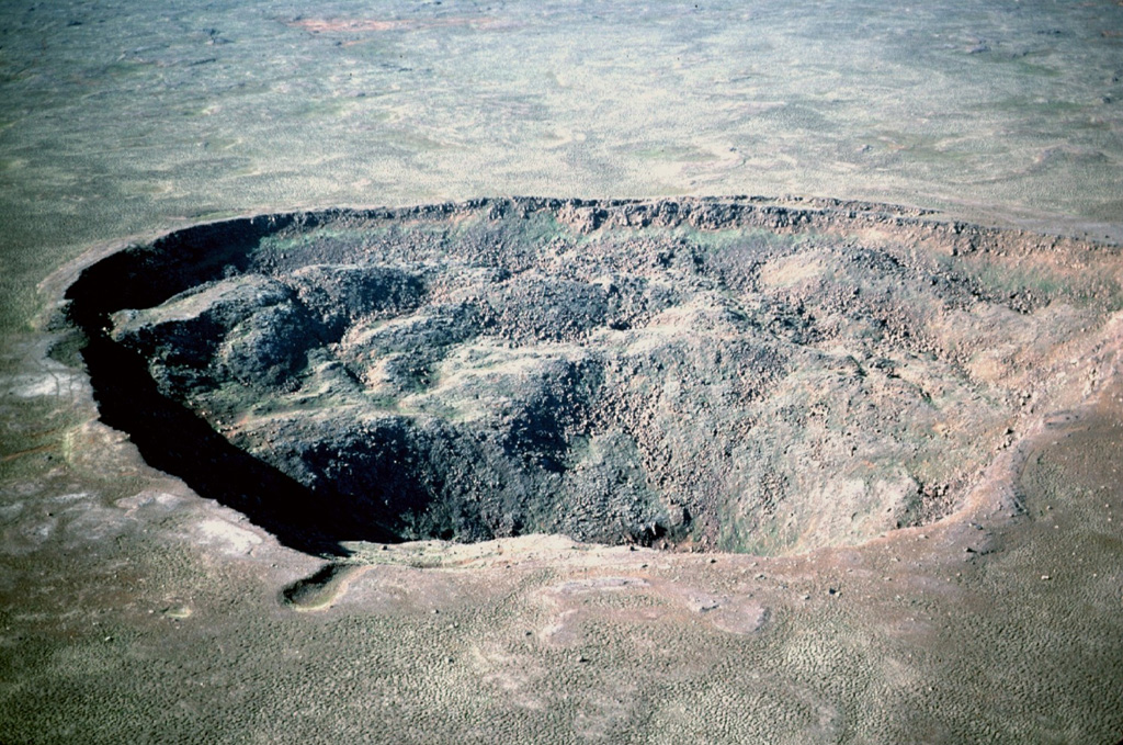
Stóravíti crater, seen here from the SE, is 600 m across and 140 m deep. It is located in the summit area of the Holocene Theistareykjarbunga shield volcano, part of the northernmost subaerial volcanic system along the Eastern Volcanic Zone of Iceland. The youngest dated eruption in this system produced the Theistareykjahraun lava flow about 2,400 years ago.
Photo by Michael Ryan, 1984 (U.S. Geological Survey).
![]() This image is made available as a Public Domain Work, but proper attribution is appreciated.
This image is made available as a Public Domain Work, but proper attribution is appreciated.
Keywords: crater
Þeistareykir