Global Volcanism Program | Image GVP-06197
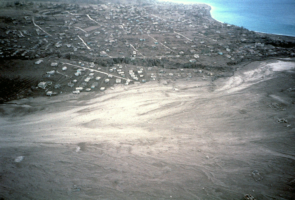
A broad plain of light-colored pyroclastic-flow deposits in the foreground partially buries the city of Plymouth, the former capital of Montserrat. This December 1997 aerial view from the north shows Fort Ghaut valley, completely filled by pyroclastic-flow deposits, cutting diagonally across the center photo. Sugar Bay lies at the upper right, just south of the port of Plymouth. Pyroclastic flows began entering Plymouth in August 1997.
Photo by Mark Davies, 1997 (Montserrat Volcano Observatory).
![]() This image is made available under the Creative Commons BY-NC 4.0 license terms.
This image is made available under the Creative Commons BY-NC 4.0 license terms.

Soufrière Hills