Global Volcanism Program | Image GVP-06375
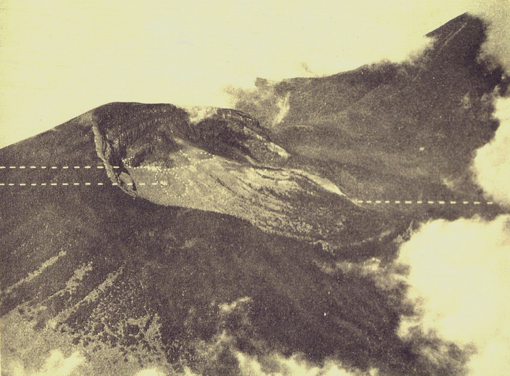
An aerial photo shows the partially forested summit of Gunung Gede volcano from the east. The two dashed lines to the left indicate the locations of Kawah Ratu (top) and Kawah Lanang craters (bottom), and the dashed line to the right indicates the site of Kawah Wadon crater. The flank of Gunung Pangrango, adjacent to Gede, is to the upper right.
Photo published in Taverne, 1926 "Vulkaanstudien op Java," (courtesy of Volcanological Survey of Indonesia).
![]() This image is made available under the Creative Commons BY-NC 4.0 license terms.
This image is made available under the Creative Commons BY-NC 4.0 license terms.
Gede-Pangrango