Global Volcanism Program | Image GVP-07442
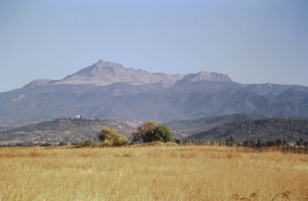
The southern flanks of Nevado de Toluca are seen here from near the town of Coatepec, with the summit peak of El Fraile to the left. The photo clearly shows the tree line on Toluca at about 4,000 m. Massive block-and-ash flows about 37,000 and 28,000 years ago extended down the southern flanks and beyond Coatepec. The hills in the foreground represent semi-vertical faces of faults forming a complex set of horst and graben structures.
Photo by José Macías, 1997 (Universidad Nacional Autónoma de México).
![]() This image is made available under the Creative Commons BY-NC 4.0 license terms.
This image is made available under the Creative Commons BY-NC 4.0 license terms.
Keywords: stratovolcano
Nevado de Toluca