Global Volcanism Program | Image GVP-07544
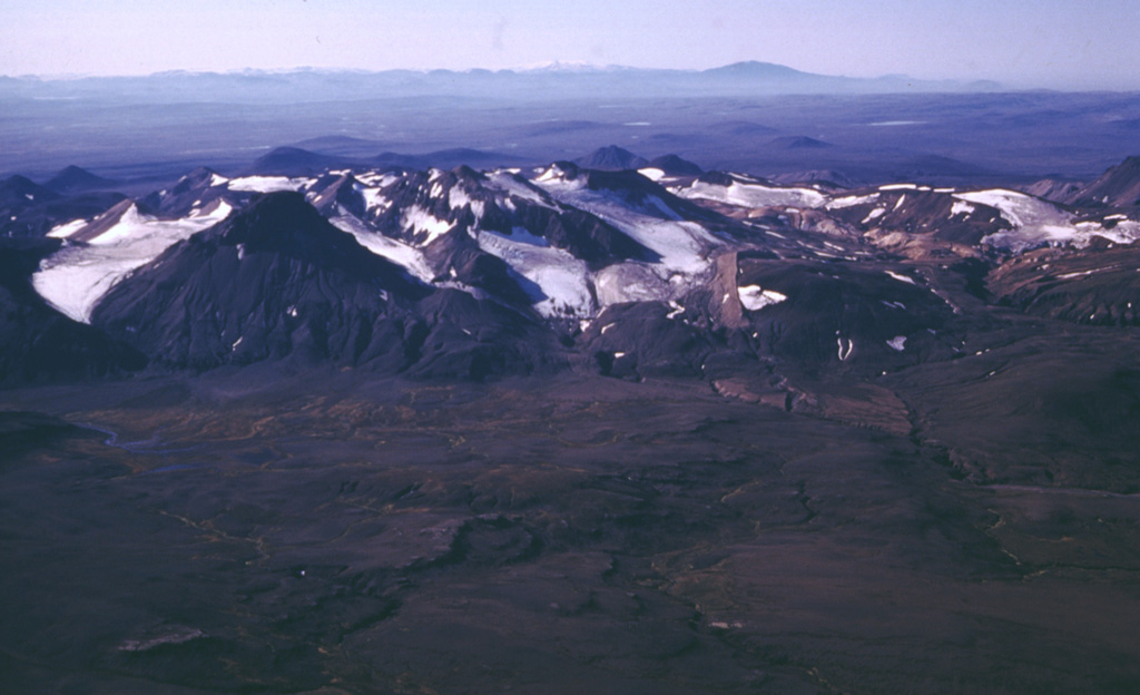
The flanks of the largely Pleistocene rhyolitic central volcano Kerlingarfjöll have been deeply dissected by glaciers, giving it a rugged appearance. This approximately 10-km-wide volcanic edifice is seen here from the NNE, separated by a topographic low (foreground) from Hofsjökull. A Holocene eruption between the two edifices produced the Illahraun lava flow. This lava flow travelled more than 20 km S and is petrologically linked to Hofsjökull. Kerlingarfjöll has a large geothermal area with vigorous fumaroles.
Photo by Oddur Sigurdsson, 1998 (Icelandic National Energy Authority).
![]() This image is made available under the Creative Commons BY-NC 4.0 license terms.
This image is made available under the Creative Commons BY-NC 4.0 license terms.
Keywords: erosion
Hofsjökull