Global Volcanism Program | Image GVP-07733
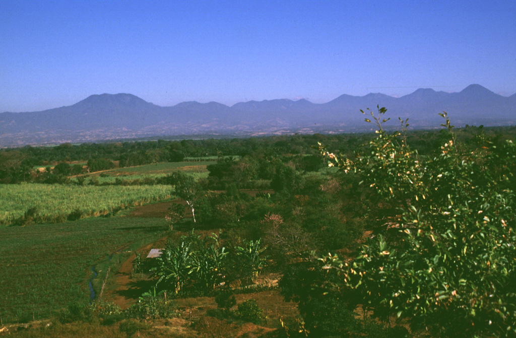
The broad E-W-trending Apaneca Range is seen here from the south with flat-topped Cerro de Apaneca on the left. The Laguna Las Ninfas -Laguna Verde complex is in the center, and to its right are Cerro Cuyanausul, Cerro los Ranas, Cerro el Aguila, and Cerro los Naranjos. The Concepción de Ataco caldera lies beyond the center horizon, behind post-caldera cones. The photo is taken from the top of a hummock on the surface of the massive Acajutla debris avalanche deposit that originated from Santa Ana volcano, which is out of view to the right.
Photo by Lee Siebert, 1999 (Smithsonian Institution).
![]() This image is made available under the Public Domain Dedication CC0 license, but proper attribution is appreciated.
This image is made available under the Public Domain Dedication CC0 license, but proper attribution is appreciated.
Keywords: stratovolcano
Apaneca Range

Santa Ana