Image GVP-08139
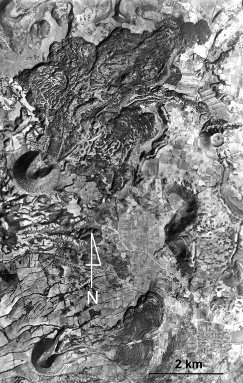
Volcán la Mina is the scoria cone near the center-left margin of the photo with the lava flow emplaced through the collapsed NE crater rim. It formed about 17,170 years ago within the Michoacan-Guanajuato volcanic field, around 90 km ENE of Parícutin. The SW cone containing a crater that also opens to the NE is Volcán el Melón (lower left), which was the source of a lava flow that traveled east to the present-day outskirts of the village of Capula.
Aerial photo by Comisión de Estudios del Territorio Nacional (CETENAL).
![]() This image is made available under the Public Domain Dedication CC0 license, but proper attribution is appreciated.
This image is made available under the Public Domain Dedication CC0 license, but proper attribution is appreciated.
Galleries: Scoria Cones
Keywords: lava flow | scoria cone | crater | volcanic field
Michoacán-Guanajuato