Global Volcanism Program | Image GVP-08141
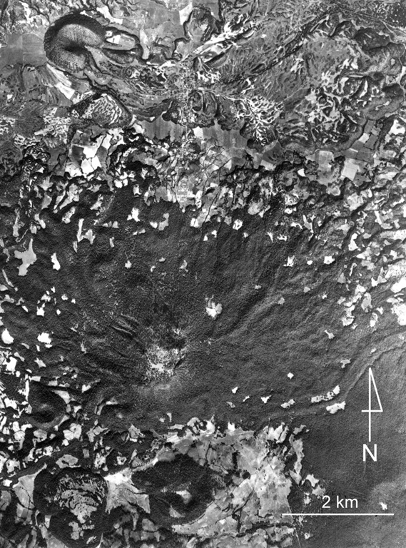
The large forested (dark) area near the center of the photo is Cerro Tecolote, an eroded stratovolcano located roughly 50 km NE of Parícutin within the Michoacan-Guanajuato volcanic field. Cerro las Cabras (upper left) is a scoria cone that produced the lava flow extending across the upper part of the photo. Mexican Highway 15 travels across the flow, which is of Pleistocene age. Cerro Pajarito is one of the scoria cones south of Cerro Tecolote, and another cone is seen here on the SW flank.
Aerial photo by Comisión de Estudios del Territorio Nacional (CETENAL).
![]() This image is made available under the Public Domain Dedication CC0 license, but proper attribution is appreciated.
This image is made available under the Public Domain Dedication CC0 license, but proper attribution is appreciated.
Galleries: Craters | Scoria Cones
Keywords: lava flow | scoria cone | crater | volcanic field
Michoacán-Guanajuato