Global Volcanism Program | Image GVP-08153
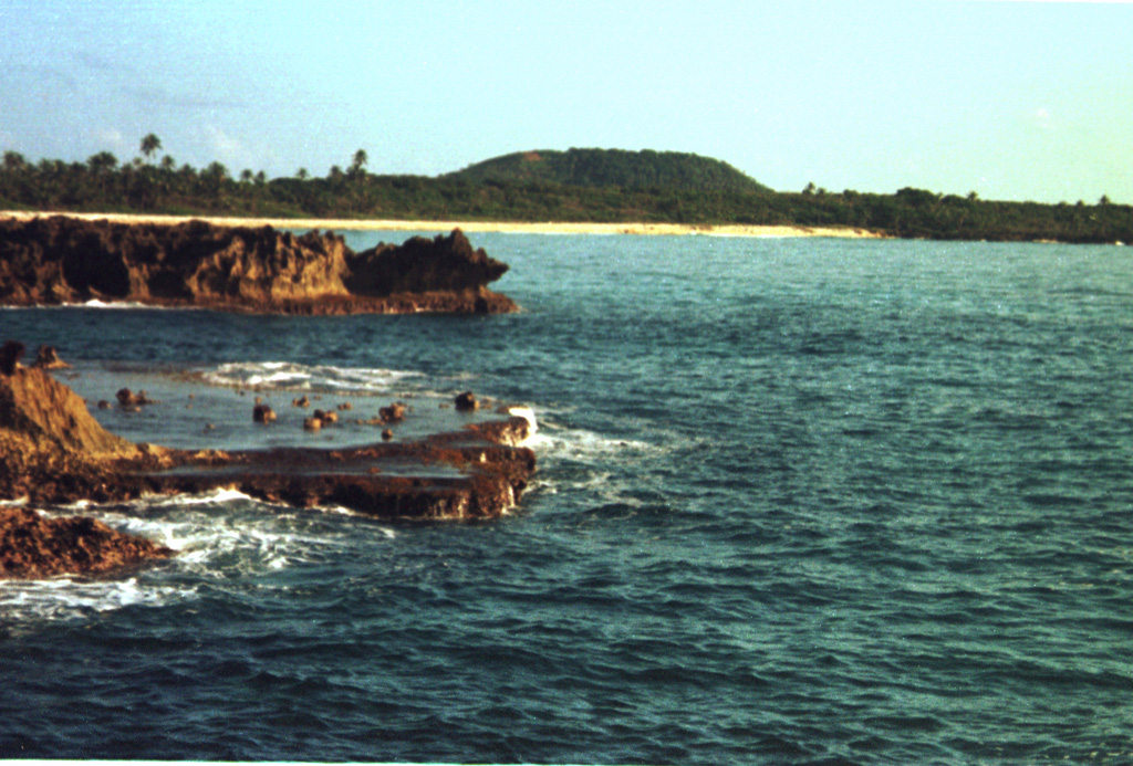
The low peak in the distance is Pumpkin Hill, a pyroclastic cone at the NE end of Utila Island. The small 74-m-high cone was erupted onto a coral-capped erosional surface forming the cliffs in the foreground and marks the high point on the island. Basaltic lavas and tuffs blanket terraces on the NE side of Utila. The island lies in the Caribbean Sea off the northern coast of Honduras and is the easternmost and lowest of the Bay Islands at the southern edge of the submarine Bartlett Trough.
Photo by Rick Wunderman, 1999 (Smithsonian Institution).
![]() This image is made available under the Public Domain Dedication CC0 license, but proper attribution is appreciated.
This image is made available under the Public Domain Dedication CC0 license, but proper attribution is appreciated.

Utila Volcanic Center