Global Volcanism Program | Image GVP-08591
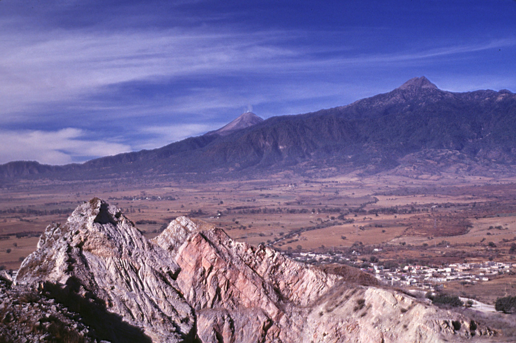
Volcán de Colima (center) and Nevado de Colima (right) are seen here from a quarry at Cerro la Escalera, 23 km NE. Up to 25 m of volcanic deposits (not visible in this photo) from both Cántaro and Colima volcanoes are exposed at Cerro la Escalera. The rocky outcrop in the foreground is a quarry wall cut in Cretaceous limestones for cement. The town of Huescalapa is visible to the lower right within the Colima graben.
Photo by Lee Siebert, 2000 (Smithsonian Institution).
![]() This image is made available under the Public Domain Dedication CC0 license, but proper attribution is appreciated.
This image is made available under the Public Domain Dedication CC0 license, but proper attribution is appreciated.

Colima