Global Volcanism Program | Image GVP-08667
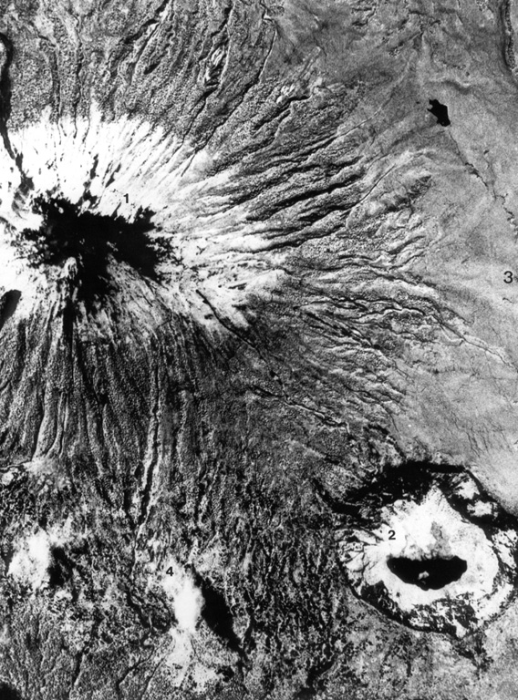
This aerial photo, with N to the upper left, shows Karisimbi (upper left) and the large 1.2-km-wide Muntango crater (lower right) located S of the summit; the 2-km-wide Branca caldera is located out of view to the right. The recent eruptions from Karisimbi produced a group of vents E of the caldera, which fed lava flows to the east, and the SW-flank lava vents.
Aerial photograph courtesy of Henry Luc Hody (Belgian ambassador).
![]() This image is made available under the Creative Commons BY-NC 4.0 license terms.
This image is made available under the Creative Commons BY-NC 4.0 license terms.
Keywords: remote sensing | caldera
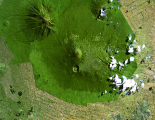
Karisimbi