Image GVP-09452

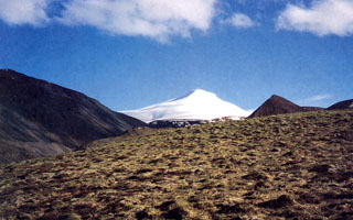
Snow-capped Mount Gordon is viewed here from the north. The composite cinder-lava cone is 5 km in diameter and 625 m high. A lava flow (out of view to the right) traveled from the base of the cone to the NW; tephra deposits from Mount Gordon are exposed primarily to the SW. Mount Gordon is the most prominent of a group of Pleistocene and Holocene cinder cones in the northern Wrangell Mountains between Mount Drum and the Nabesna Glacier river system.
Photo by Donald Richter, 1994 (U.S. Geological Survey, published in Richter et al., 1995).
![]() This image is made available as a Public Domain Work, but proper attribution is appreciated.
This image is made available as a Public Domain Work, but proper attribution is appreciated.
Gordon