Global Volcanism Program | Image GVP-09659
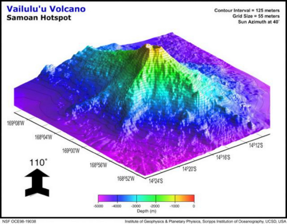
This view of Vailulu'u seamount to the NW displays three major rifts toward the W, SE, and W. The lower slopes of Vailulu'u and Ta'u merge along the W ridge, with a saddle at 3,200 m and a diameter of ~35 km at its base. An earthquake swarm in 1995 may have been related to an eruption at Vailulu'u, which was not discovered until 1975. It rises 4,200 m from the sea floor to a depth of about 600 m between Ta'u and Rose islands at the eastern end of the American Samoas.
Image by Hart and others (Global Volcanism Network Bulletin, 2001).
![]() This image is made available under the Creative Commons BY-NC 4.0 license terms.
This image is made available under the Creative Commons BY-NC 4.0 license terms.
Keywords: submarine volcano | stratovolcano | remote sensing | technology | DEM | map | bathymetry
Vailulu'u