Image GVP-10055
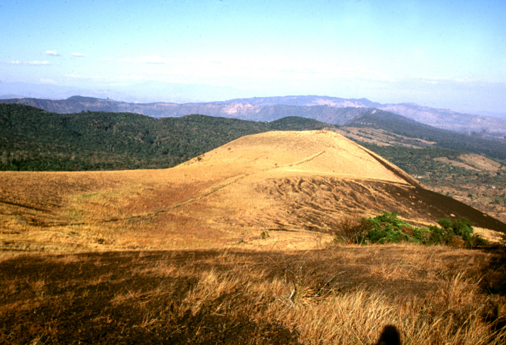
San Marcelino scoria cone is seen from Cerro Chino on the SE flank of Santa Ana. San Marcelino formed during an eruption in 1722 and produced a lava flow that traveled 13 km to the east. The vegetated southern rim of Coatepeque caldera can be seen to the NE (left) of San Marcelino.
Photo by Lee Siebert, 2002 (Smithsonian Institution).
![]() This image is made available under the Public Domain Dedication CC0 license, but proper attribution is appreciated.
This image is made available under the Public Domain Dedication CC0 license, but proper attribution is appreciated.
Keywords: scoria cone

Santa Ana
Coatepeque Caldera