Image GVP-10190
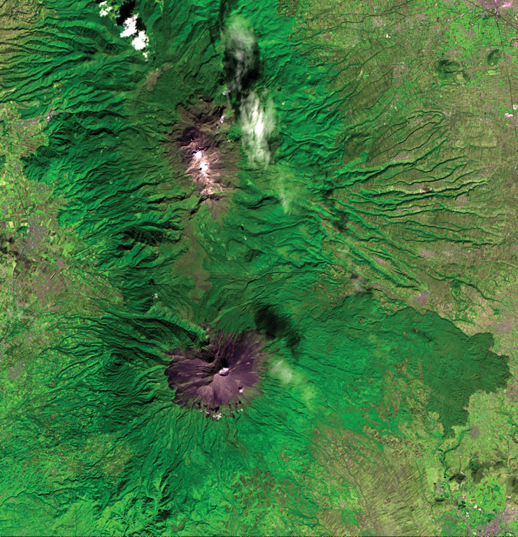
The N-S-trending Popocatépetl-Iztaccíhuatl volcanic chain lies between the Valley of Mexico and the Puebla basin. Snow-capped Iztaccíhuatl volcano lies just above the center of the image. The city of Texmelucan can be seen at the upper right. Across the Paso de Cortés from Iztaccíhuatl is steaming Popocatépetl volcano, located SE of the city of Amecameca (mid-left margin). A voluminous prehistorical lava field from Popocatépetl forms the forested lobe extending about 20 km down the eastern flank at the lower right.
ASTER satellite image, 2001 (National Aeronautical and Space Administration, processed by Doug Edmonds).
![]() This image is made available under the Creative Commons BY-NC 4.0 license terms.
This image is made available under the Creative Commons BY-NC 4.0 license terms.
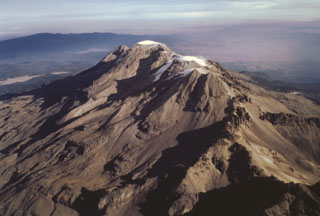
Iztaccíhuatl

Popocatépetl