Global Volcanism Program | Image GVP-10269
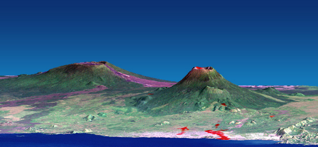
This combined NASA Landsat and Shuttle Radar Topography Mission image shows Nyamuragira (left) and Nyiragongo (right) volcanoes rising north of Lake Kivu in the East African Rift Valley. Red areas on Nyiragongo mark the locations of January 2002 flank-vent lava flows, some of which descended through the city of Goma into Lake Kivu. Historical lavas descend from Nyamuragira shield volcano, some of which also reached the lake. Both volcanoes are truncated by small calderas.
NASA Landsat and SRTM image, 2002.
![]() This image is made available as a Public Domain Work, but proper attribution is appreciated.
This image is made available as a Public Domain Work, but proper attribution is appreciated.
Keywords: stratovolcano | remote sensing | lava flow

Nyamulagira

Nyiragongo