Image GVP-10339

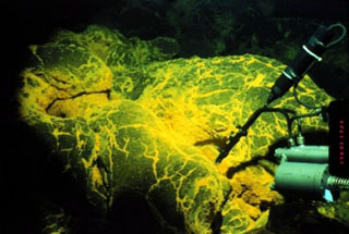
The linear NE-SW-trending CoAxial Segment (center) of the Juan de Fuca Ridge is located about 435 km W of the Oregon coast. It lies NE of Axial volcano, which is in the bottom-left of this map. A submarine eruption along the CoAxial segment detected by acoustic hydrophones in June 1993 produced thermal plumes and a new lava flow. Bathymetric surveys indicated that one or more additional sea floor lava extrusions took place nearby sometime between 1981-82 and 1991.
Image courtesy of National Oceanic and Atmospheric Administration (http://www.pmel.noaa.gov/vents/home.html).
![]() This image is made available as a Public Domain Work, but proper attribution is appreciated.
This image is made available as a Public Domain Work, but proper attribution is appreciated.
Keywords: submarine volcano | technology | bathymetry | remote sensing | DEM
CoAxial Segment