Image GVP-10422
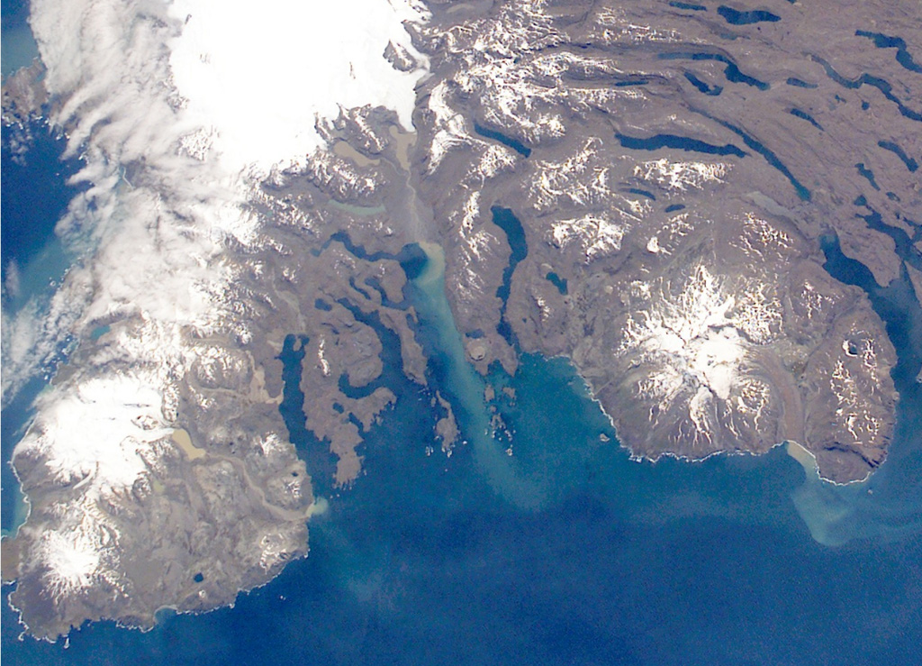
The Rallier du Baty Peninsula (bottom left) forms the SW tip of Kerguelen Island. It contains two subglacial eruptive centers, Mont St. Allouarn and Mont Henri Rallier du Baty. An active fumarole field is related to a series of Holocene trachytic lava flows and lahars that extend beyond the icecap. The snow-covered peak at the mid-right is late-Pleistocene Mount Ross stratovolcano. The Kerguelen Islands are composed primarily of Tertiary flood basalts and a complex of plutonic rocks extensively modified by glaciation.
NASA International Space Station image ISS005-E-21805, 2002 (http://eol.jsc.nasa.gov/).
![]() This image is made available as a Public Domain Work, but proper attribution is appreciated.
This image is made available as a Public Domain Work, but proper attribution is appreciated.
Keywords: remote sensing | erosion

Kerguelen Islands