Global Volcanism Program | Image GVP-10437
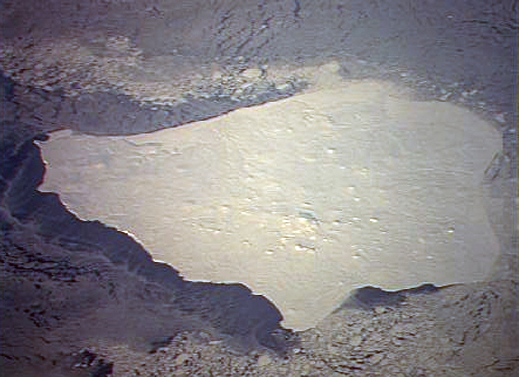
Low-angle sun accentuates small pyroclastic cones on snow-covered Nunivak Island. Shelf ice modifies the apparent northern coastline (top) in this January 1992 Space Shuttle image. The 110-km-wide island lies about 30 km off the coast of SW Alaska and contains about 60 cinder cones and four maars. Although the bulk of the volcanic field was formed during two Pleistocene eruptive periods ending about 300,000 years ago, activity continued into the Holocene. The latest eruptions occurred along an E-W line in the southern part of the island.
NASA Space Shuttle image STS42-82-33, 1992 (http://eol.jsc.nasa.gov/).
![]() This image is made available as a Public Domain Work, but proper attribution is appreciated.
This image is made available as a Public Domain Work, but proper attribution is appreciated.
Nunivak Island