Global Volcanism Program | Image GVP-10459
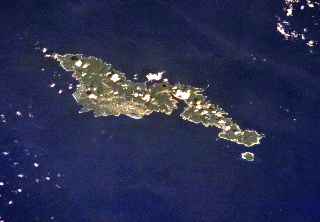
The elongated, 32-km-long island of Tutuila in the center of the Samoan Islands is seen in this International Space Station view (with north to the upper right). Five Pliocene-to-Pleistocene volcanoes were constructed along rift zones, and the Pago shield volcano in the center of the island was truncated by an eroded, 9-km-wide caldera that incorporates Pago Pago harbor (right-center). Following a lengthy period of erosion, the Leone tuff cones and cinder cones were erupted during the Holocene across the southernmost portion of the island (left-center).
NASA International Space Station image ISS002-701-263, 2001 (http://eol.jsc.nasa.gov/).
![]() This image is made available as a Public Domain Work, but proper attribution is appreciated.
This image is made available as a Public Domain Work, but proper attribution is appreciated.
Keywords: island volcano
Tutuila