Image GVP-10562
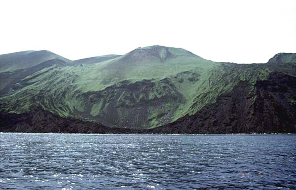
Oshima-Oshima volcano is seen here from the N with the Kanpodake cone (back-center) that formed during the 1741 eruption. Major edifice collapse that year produced a large scarp open to the north, with the walls visible at the sides of the image. The 4-km-wide island is 55 km W of the SW tip of Hokkaido, and is the emergent summit of two coalescing volcanoes: Higashiyama at the eastern end of the island, and Nishiyama at the western end.
Copyrighted photo by Tomoyo Hayakawa (Japanese Quaternary Volcanoes database, RIODB, http://riodb02.ibase.aist.go.jp/strata/VOL_JP/EN/index.htm and Geol Surv Japan, AIST, http://www.gsj.jp/).
Copyrighted image used with permission. All Rights Reserved. Contact photographer for any usage requests.
Keywords: island volcano | cone | landslide scarp
Oshima-Oshima