Image GVP-10693
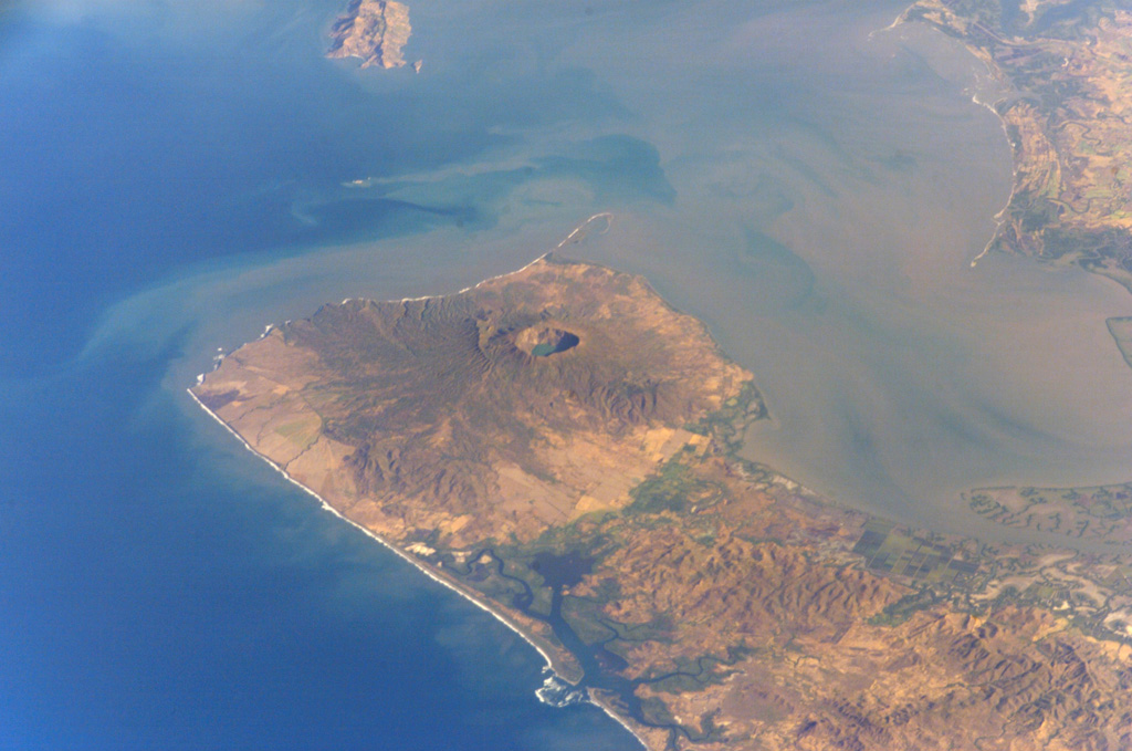
Cosigüina volcano forms the northern half of a 25-km-wide peninsula extending NW-ward into the Gulf of Fonseca. A 2-km-wide caldera, partially filled by a lake, truncates the summit of the volcano, and the scarp of a larger older caldera is visible to the NW. Pyroclastic flows from the catastrophic 1835 eruption, the largest in Nicaragua during historical time, reached the Gulf of Fonseca. The volcanic island of Meanguera in the El Salvador side of the Gulf of Fonseca is visible at the top left.
NASA International Space Station image ISS004-E-9143, 2002 (http://eol.jsc.nasa.gov/).
![]() This image is made available as a Public Domain Work, but proper attribution is appreciated.
This image is made available as a Public Domain Work, but proper attribution is appreciated.
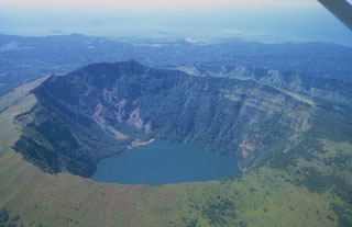
Cosigüina