Image GVP-10994
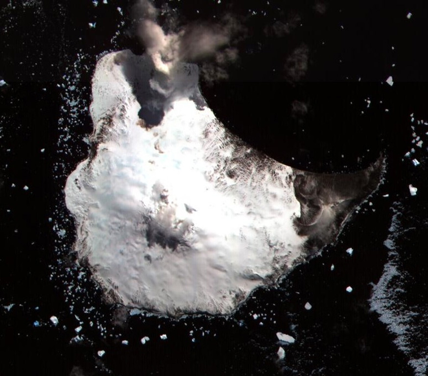
Glacier-covered Mount Michael stratovolcano dominates Saunders Island. Cordelia Bay lies between the Blackstone Plain (top) and the snow-free Ashen Hills (right), a cluster of parasitic cones on the SE flank. Ash clouds were reported from the summit crater in 1819, and an effusive eruption was inferred to have occurred from a north-flank fissure around the turn of the 19th century. Recent AVHRR and MODIS satellite imagery has revealed evidence for lava lake activity in the summit crater of Mount Michael.
ASTER satellite image, 2002 (National Aeronautical and Space Administration, courtesy of ASTER science team).
![]() This image is made available under the Creative Commons BY-NC 4.0 license terms.
This image is made available under the Creative Commons BY-NC 4.0 license terms.
Saunders