Global Volcanism Program | Image GVP-11059
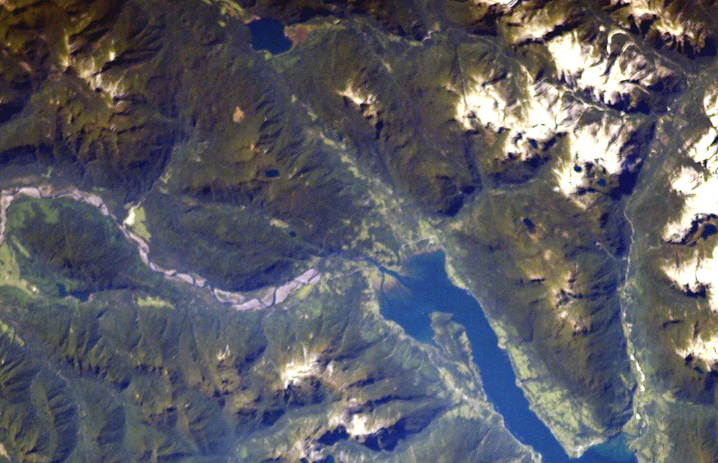
The major regional N-S-trending Liquiñe-Ofqui fault extends along the Estuario Reloncaví (lower right) through Ralún Bay (center) to Lake Cayutúe (just left of the top of the image). About 20 basaltic cinder cones, maars, and lava flows of the Cayutué-La Viguería volcanic field lie along this lineament. La Viguería and Volcán Cayutué are the principal cones. The former temporarily dammed the Río Petrohué, the meandering stream at the left.
NASA International Space Station image ISS006-E-42993, 2003 (http://eol.jsc.nasa.gov/).
![]() This image is made available as a Public Domain Work, but proper attribution is appreciated.
This image is made available as a Public Domain Work, but proper attribution is appreciated.
Cayutué-La Viguería