Global Volcanism Program | Image GVP-11061
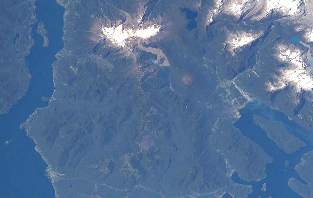
The forested volcanic complex in the lower center of this NASA Space Station image (with north to the left) is Hualique (also known as Apagado). This stratovolcano is located SW of snow-covered Yate volcano (top; left of center) and occupies the peninsula between the Gulf of Ancud and the Reloncaví estuary (upper left). A 6-km-wide caldera is open to the SW. Hornopirén volcano is the small rounded brownish peak below and to the right of Yate volcano.
NASA International Space Station image ISS006-E-42995, 2003 (http://eol.jsc.nasa.gov/).
![]() This image is made available as a Public Domain Work, but proper attribution is appreciated.
This image is made available as a Public Domain Work, but proper attribution is appreciated.
Apagado