Image GVP-11096
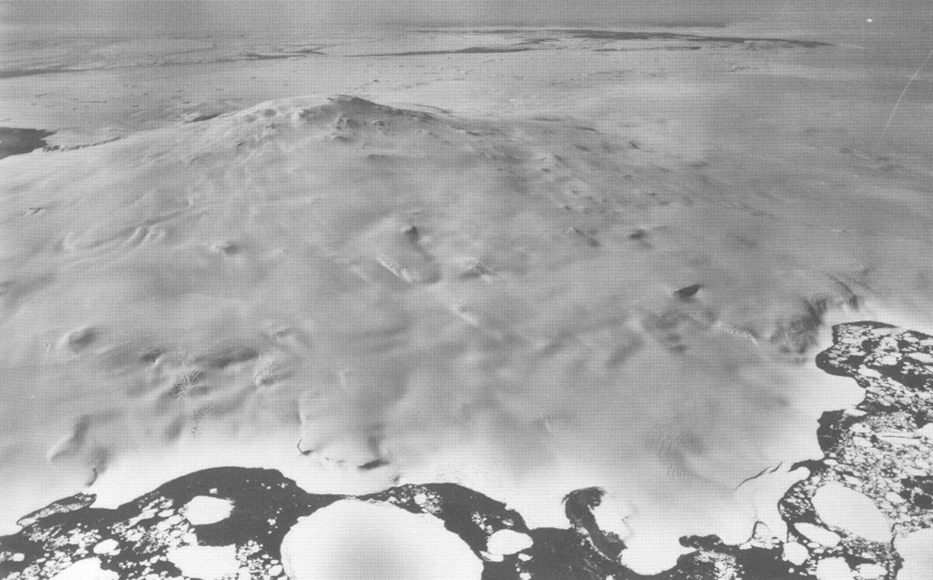
Mount Siple forms the high point of Siple Island in Marie Byrd Land off the coast of Antarctica. This aerial view looks east, with dark-colored open water in the foreground and the Getz Ice Shelf between the island and Antarctica. Most volcanic features are buried in snow and ice, but the Lovill Bluff tuff cone outcrops at sea level (bottom right). Trachytic rocks at the summit have been Ar-Ar dated to about 227,000 and 169,000 years old.
U. S. Navy photo TMA 1627 F33 088, 1985.
![]() This image is made available as a Public Domain Work, but proper attribution is appreciated.
This image is made available as a Public Domain Work, but proper attribution is appreciated.
Keywords: stratovolcano

Siple