Image GVP-11127
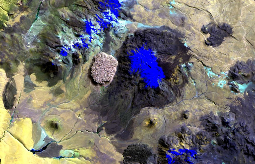
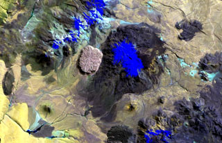
The youthful-looking rhyolitic lava dome, Cerro la Torta (left of center), lies at its western foot of Cerros de Tocorpuri (or Volcán Tocorpuri), a stratovolcano complex on the Chile-Bolivia border. The circular, roughly 5 cu km Cerro la Torta has a flat-topped surface with wrinkled flow ridges and terminates in steep, talus-covered margins about 150 m high. The dome has a youthful appearance, but its age is not precisely known. Snow cover in this Landsat view is deep blue.
NASA Landsat image, 1999 (courtesy of Hawaii Synergy Project, Univ. of Hawaii Institute of Geophysics & Planetology).
![]() This image is made available as a Public Domain Work, but proper attribution is appreciated.
This image is made available as a Public Domain Work, but proper attribution is appreciated.
Cerros de Tocorpuri