Global Volcanism Program | Image GVP-11129

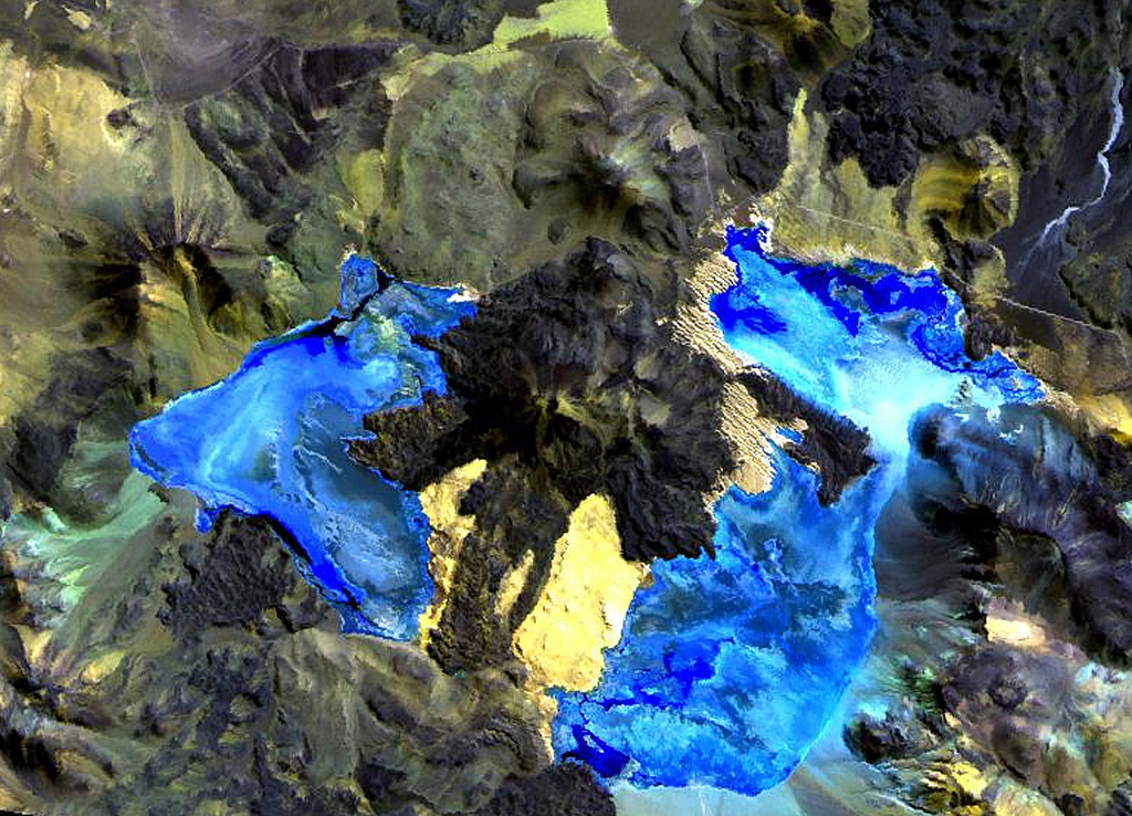
Caichinque volcano forms a topographic high dividing lakes of Salar Capur (left) from Salar Talar (right). More than a half dozen vents produced andesitic-to-dacitic lava flows, with young flows descending to the NE and SE from the 4450-m-high summit. One prominent flow traveled 6 km to the east, forming two lobes extending into the Salar Talar. Other youthful looking flows traveled to the west, forming lobes extending into Salar Capur, and SSW, dividing the two salars.
NASA Landsat image, 1999 (courtesy of Hawaii Synergy Project, Univ. of Hawaii Institute of Geophysics & Planetology).
![]() This image is made available as a Public Domain Work, but proper attribution is appreciated.
This image is made available as a Public Domain Work, but proper attribution is appreciated.

Caichinque
