Global Volcanism Program | Image GVP-11144
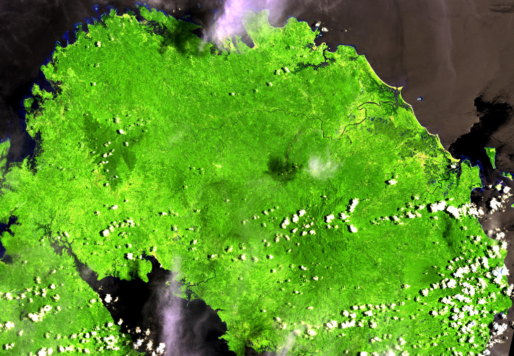
This Landsat image shows the forested Labo lies between the Ragay Gulf (lower left) and Pacific Ocean (top) at the NW end of the Bicol Peninsula in SE Luzon. It is surrounded by numerous lava domes. Eruptive activity ceased during the Pleistocene, but thermal activity in the form of hot and warm springs continues.
NASA Landsat image, 2000 (courtesy of Hawaii Synergy Project, Univ. of Hawaii Institute of Geophysics & Planetology).
![]() This image is made available as a Public Domain Work, but proper attribution is appreciated.
This image is made available as a Public Domain Work, but proper attribution is appreciated.
Labo