Global Volcanism Program | Image GVP-11185
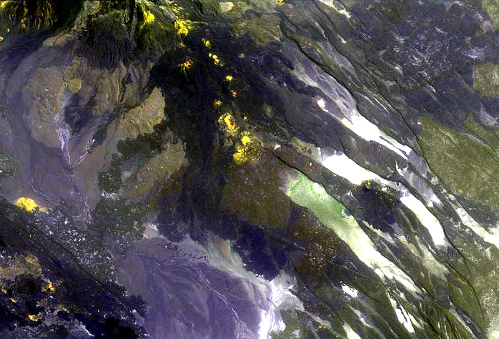
The chain of pyroclastic cones and lava flows extending diagonally down from the upper-left portion of this Landsat image is the southern portion of the Mousa Alli volcanic complex. The flanks of its neighbor to the SW, Manda Inakir, are visible at the extreme lower left. Prominent faults at the right cut lava flows of the Pliocene-Pleistocene stratoid series of the Afar region.
NASA Landsat image, 1999 (courtesy of Hawaii Synergy Project, Univ. of Hawaii Institute of Geophysics & Planetology).
![]() This image is made available as a Public Domain Work, but proper attribution is appreciated.
This image is made available as a Public Domain Work, but proper attribution is appreciated.
Mousa Alli