Global Volcanism Program | Image GVP-11219
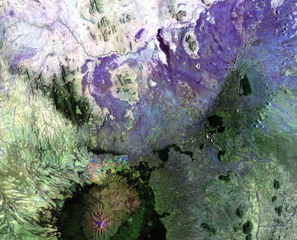
The broad NE-SW-trending Nyambeni Hills shield volcano cuts diagonally across this NASA Landsat image from the center to the upper right. It is located NE of the eroded Pleistocene Mount Kenya volcano (lower left) and is capped by numerous phonolitic lava domes and basaltic cones and lava flows. The basaltic scoria cones are the youngest features of Nyambeni Hills volcano and are clustered in a NE-trending belt along the crest of the shield and in N-S-trending areas on its flanks.
NASA Landsat image, 1999 (courtesy of Hawaii Synergy Project, Univ. of Hawaii Institute of Geophysics & Planetology).
![]() This image is made available as a Public Domain Work, but proper attribution is appreciated.
This image is made available as a Public Domain Work, but proper attribution is appreciated.
Keywords: remote sensing | lava flow
Nyambeni Hills