Image GVP-11308
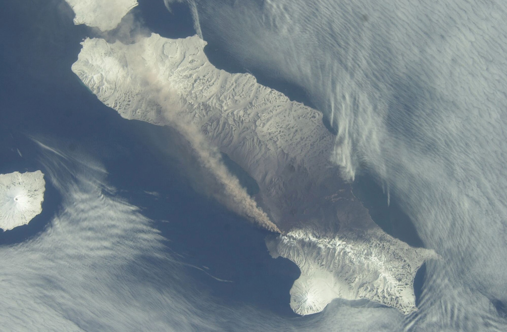
An ash plume extends across the length of Paramushir Island in the northern Kuril Islands on 26 April 2003 in this NASA Space Shuttle image (with N to the left). An explosive eruption of Chikurachki began on 18 April, producing ash plumes up to about 2 km above the crater. On 1 May ash fell on the town of Severo-Kurilsk (~60 km from the volcano), and intermittent activity continued until early July. Alaid volcano is at the far left.
NASA International Space Station image ISS006-E-52695, 2003 (http://eol.jsc.nasa.gov/).
![]() This image is made available as a Public Domain Work, but proper attribution is appreciated.
This image is made available as a Public Domain Work, but proper attribution is appreciated.
Galleries: Ash Plumes and Ashfall | Remote Sensing
Keywords: eruption | ash | ash plume | remote sensing | deposit | wind dispersal | ashfall | tephra
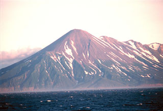
Chikurachki