Global Volcanism Program | Image GVP-11349
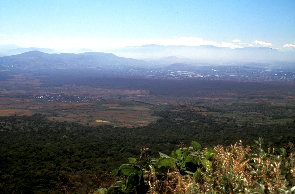
The darker forested area in the center of this photo, extending from the middle right almost across the broad valley floor, is the Texcal lava flow. This lava flow traveled 24 km S onto the Cuernavaca plain after being erupted about 4,200 years ago from the Guespalapa scoria cone. Unlike the Pelado or Chichinautzin eruptions, the Guespalapa eruption did not produce a small shield, but rather one of the longest lava flows of the Sierra Chichinautzin.
Photo by Lee Siebert, 2004 (Smithsonian Institution).
![]() This image is made available under the Public Domain Dedication CC0 license, but proper attribution is appreciated.
This image is made available under the Public Domain Dedication CC0 license, but proper attribution is appreciated.
Chichinautzin