Image GVP-11422
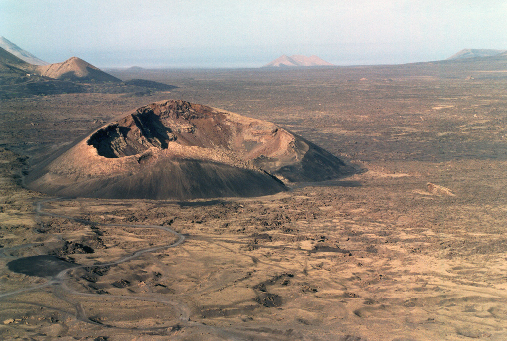
The Caldera de los Cuervos (left center) was formed during the initial stage of the eruption during 1730 to 1736. Eruptions from a 13-15 km long NE-SW trending fissure formed more than 30 cones and produced voluminous lava flows that covered about 250 km2, reaching the western coast. A third of the farmland and numerous villages were buried in ash during this six-year long eruption.
Photo by Raphaël Paris, 2001 (CNRS, Clermont-Ferrand).
![]() This image is made available under the Creative Commons BY-NC-ND 4.0 license terms.
This image is made available under the Creative Commons BY-NC-ND 4.0 license terms.
Keywords: crater | scoria cone
Lanzarote