Image GVP-11450
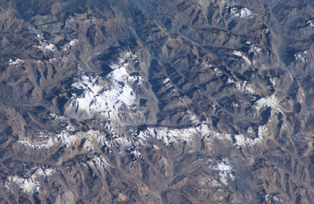
A complex of snow-covered cones (left-center) partially fills the 30 x 45 km wide Caldera del Atuel, which lies just east of the Argentina-Chile border. The headwaters of the Río del Atuel drain to the SE through a wide breach in the caldera rim (top center) in this NASA International Space Station image (with north to the bottom left). The snow-covered Volcán Overo and Sosneado complexes in the eastern part of the caldera contain numerous very youthful basaltic-to-andesitic pyroclastic cones and lava flows.
NASA International Space Station image ISS010-E-19060, 2005 (http://eol.jsc.nasa.gov/).
![]() This image is made available as a Public Domain Work, but proper attribution is appreciated.
This image is made available as a Public Domain Work, but proper attribution is appreciated.

Caldera del Atuel