Image GVP-11474
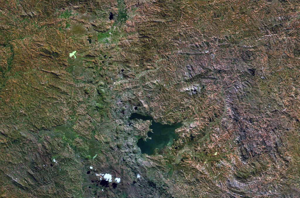
The Itasy volcanic field in central Madagascar lies W of Lake Itasy (lower center) and consists of a N-S-trending chain of scoria cones, lava domes, and maars. Several small dark-colored, lake-filled maars can be seen in the NASA Landsat image (N to the top), one of which lies just above the NW arm of Lake Itasy. Early eruptions producing trachytic lava domes and basanitic lava flows were followed by the effusion of trachytic lava flows and recent Vulcanian eruptions. Mild seismicity and hot spring activity continue at Itasy.
NASA Landsat 7 image (worldwind.arc.nasa.gov)
![]() This image is made available as a Public Domain Work, but proper attribution is appreciated.
This image is made available as a Public Domain Work, but proper attribution is appreciated.
Keywords: remote sensing
Itasy Volcanic Field