Image GVP-11495
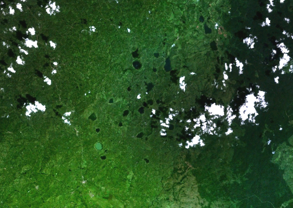
Mostly lake-filled maars and tuff cones dot the center of this NASA Landsat image (with N to the top) of the Kyatwa volcanic field. The Kyatwa vents, also known as the Ndale volcanic field, occupy the Western Rift Valley, east of the Ruwenzori Mountains halfway between Lake Edward and Lake Albert. The Kyatwa tuff cones are part of a group of Pleistocene-to-recent volcanic fields in western Uganda.
NASA Landsat 7 image (worldwind.arc.nasa.gov)
![]() This image is made available as a Public Domain Work, but proper attribution is appreciated.
This image is made available as a Public Domain Work, but proper attribution is appreciated.
Galleries: Maars
Keywords: remote sensing | crater | maar | crater lake

Ndali-Kasenda Volcanic Field