Global Volcanism Program | Image GVP-11545
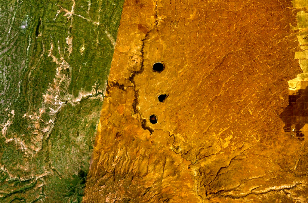
Three lake-filled maars occupy the center of this NASA Landsat composite image (with N to the top). Active hot springs and fumaroles are located in this area.
NASA Landsat 7 image (worldwind.arc.nasa.gov)
![]() This image is made available as a Public Domain Work, but proper attribution is appreciated.
This image is made available as a Public Domain Work, but proper attribution is appreciated.
Galleries: Maars
Keywords: maar | remote sensing

Bilate River Field