Global Volcanism Program | Image GVP-11710
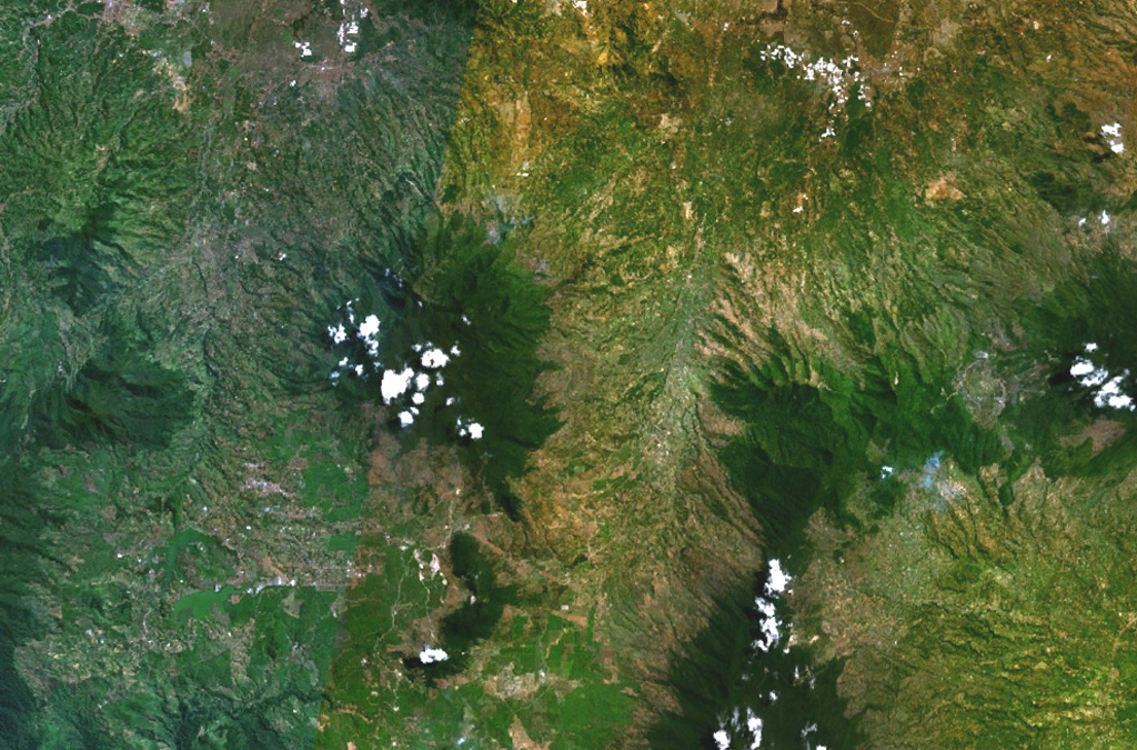
The forested Gunung Malabar stratovolcano is the dark-green, partially cloud-covered area (left-center) in this composite NASA Landsat image of western Java (with north to the top). Malabar lies immediately south of the major city of Bandung, partially visible at the top left. The broad, 2343-m-high basaltic andesite Malabar volcano rises north of Wayang-Windu lava dome (the elongated dark-green area), west of Kawah Kamojang and Guntur volcanoes (right-center), and NW of Kendang volcano (bottom right-center).
NASA Landsat 7 image (worldwind.arc.nasa.gov)
![]() This image is made available as a Public Domain Work, but proper attribution is appreciated.
This image is made available as a Public Domain Work, but proper attribution is appreciated.
Malabar