Image GVP-11728
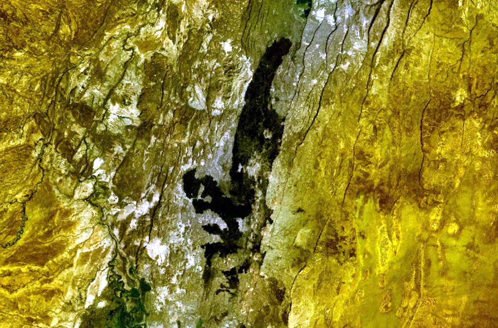
The dark-colored area cutting across the center of this NASA Landsat image (with north to the top) is a series of basaltic lava flows erupted from fissure vents at Hertali. These flows lie at the S end of the Awash Plain, about 50 km NNE of Dofen volcano. The youthful morphology of the flows suggests a late Pleistocene to Holocene age. Numerous NNE-SSW-trending fissures of the Ethiopian Rift are visible.
NASA Landsat 7 image (worldwind.arc.nasa.gov)
![]() This image is made available as a Public Domain Work, but proper attribution is appreciated.
This image is made available as a Public Domain Work, but proper attribution is appreciated.
Keywords: remote sensing | lava flow

Hertali