Global Volcanism Program | Image GVP-11864
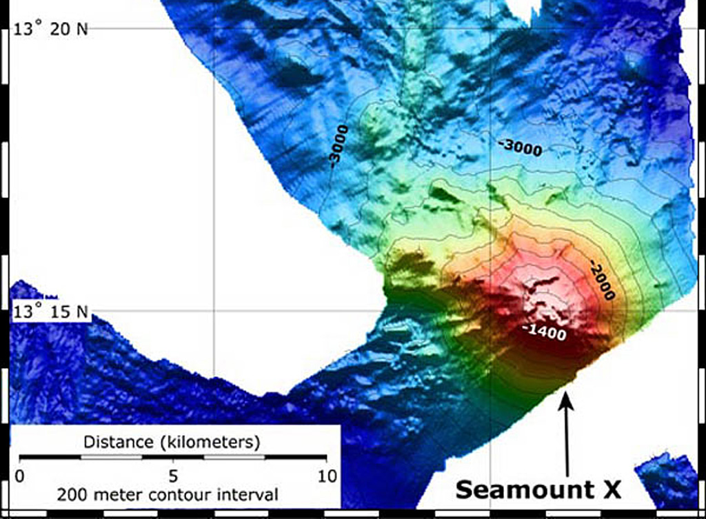
A bathymetric map showing Seamount X was produced using data from 2004 and 2006 NOAA submarine vents expeditions. The seamount lies about 70 km WSW of Guam and displays areas of hydrothermal venting. The contour interval is 200 m.
Image courtesy of Susan Merle (Oregon State University/NOAA Vents Program).
![]() This image is made available as a Public Domain Work, but proper attribution is appreciated.
This image is made available as a Public Domain Work, but proper attribution is appreciated.
Galleries: Technology | Submarine Volcanoes
Keywords: submarine volcano | remote sensing | technology | model | DEM | bathymetry
Seamount X