Image GVP-11888
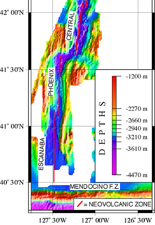
A NOAA/PMEL map shows the setting of the Escanaba Segment at the southern end of the Gorda Ridge west of the coast of northern California. The linear N-S-trending segment is the southernmost of the five segments of the Gorda Ridge, and lies immediately north of the Mendocino Fracture Zone. The axial crest of the 130-km-long segment, also known as the Escanaba Trough, is about 3-5 km wide at the northern end and widens to 18 km in the south near the junction with the Mendocino Fracture Zone.
Courtesy of NOAA NeMo Observatory.
![]() This image is made available as a Public Domain Work, but proper attribution is appreciated.
This image is made available as a Public Domain Work, but proper attribution is appreciated.
Keywords: submarine volcano | DEM | technology | remote sensing | bathymetry

Escanaba Segment