Global Volcanism Program | Image GVP-11904
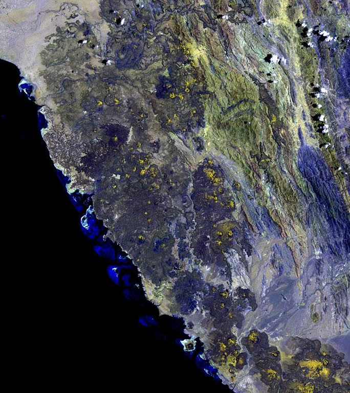
The 1,800 km2 Miocene and Quaternary Harrat al Birk volcanic field extends diagonally across the center of this NASA Landsat image along the Red Sea coast. Dark-colored areas are lava fields and yellowish areas mark scoria cones and deposits. Scoria cones occur throughout the field, and a few outlying cones lie E of the main lava field.
NASA Landsat image, 2003 (USGS).
![]() This image is made available as a Public Domain Work, but proper attribution is appreciated.
This image is made available as a Public Domain Work, but proper attribution is appreciated.
Galleries: Volcanic Fields
Keywords: volcanic field | lava flow | remote sensing
Harrat al Birk